UCLA geologists have devised an innovative method employing artificial intelligence to enhance the prediction of potential landslide locations, a development that could significantly boost safety measures in regions frequently afflicted by natural calamities.
This method proves particularly useful in areas like California, researchers propose, where the mix of droughts, wildfires, and earthquakes sets the stage for potential landslide catastrophes. Climate change implications, like intensified and wetter storms, are predicted to exacerbate this situation.
Numerous variables contribute to a landslide occurrence, such as terrain configuration, slope and drainage areas, soil and bedrock composition, and environmental elements like climate, rainfall, hydrology, and seismic activity. Given this array of variables, determining when and where the earth might lose its stability can be both a scientific and artistic task.
Traditionally, geologists have estimated the risk of landslides in an area by incorporating these factors into physical and statistical models. Such models can deliver fairly accurate predictions with sufficient data, but physical models demand extensive time and resources and can't be generalized over larger areas. Meanwhile, statistical models provide limited insights into how they weigh different risk factors to derive their predictions.
In recent years, AI machine learning models, specifically deep neural networks (DNNs), have been trained by researchers to predict landslides. These sophisticated networks of algorithms can swiftly process and "learn" from extensive landslide-related data to make highly precise predictions.
Despite their efficiency in processing and learning, DNNs, like statistical models, do not make their processes transparent. This opacity makes it challenging for researchers to interpret predictions and identify the significant factors to address when attempting to prevent potential landslides.
"DNNs provide a probability of a landslide that may be accurate, but we can't discern why and which specific variables were most influential in causing the landslide," remarked Kevin Shao, a doctoral student in Earth, planetary and space sciences and co–first author of the journal paper.
Khalid Youssef, a co–first author, former biomedical engineering student, and postdoctoral researcher at UCLA, noted that the intertwining layers of DNNs continuously interact during the learning process, making their analysis impenetrable. This issue was targeted by UCLA researchers in their new method.
"We aimed to create a clear distinction between the results from the various data inputs, enhancing the analysis's utility in determining the most significant contributors to natural disasters," he said.
Youssef and Shao collaborated with co–corresponding authors Seulgi Moon, a UCLA associate professor of Earth, planetary and space sciences, and Louis Bouchard, a UCLA professor of chemistry and bioengineering, to devise an approach that could separate the DNNs' analytic capacity from their complex nature to produce more actionable outcomes.
Their method utilizes a form of AI known as a superposable neural network (SNN). In an SNN, the network's layers run parallel to each other—maintaining the capacity to assess complex relationships between data inputs and output results—but only merge at the end to provide the prediction.
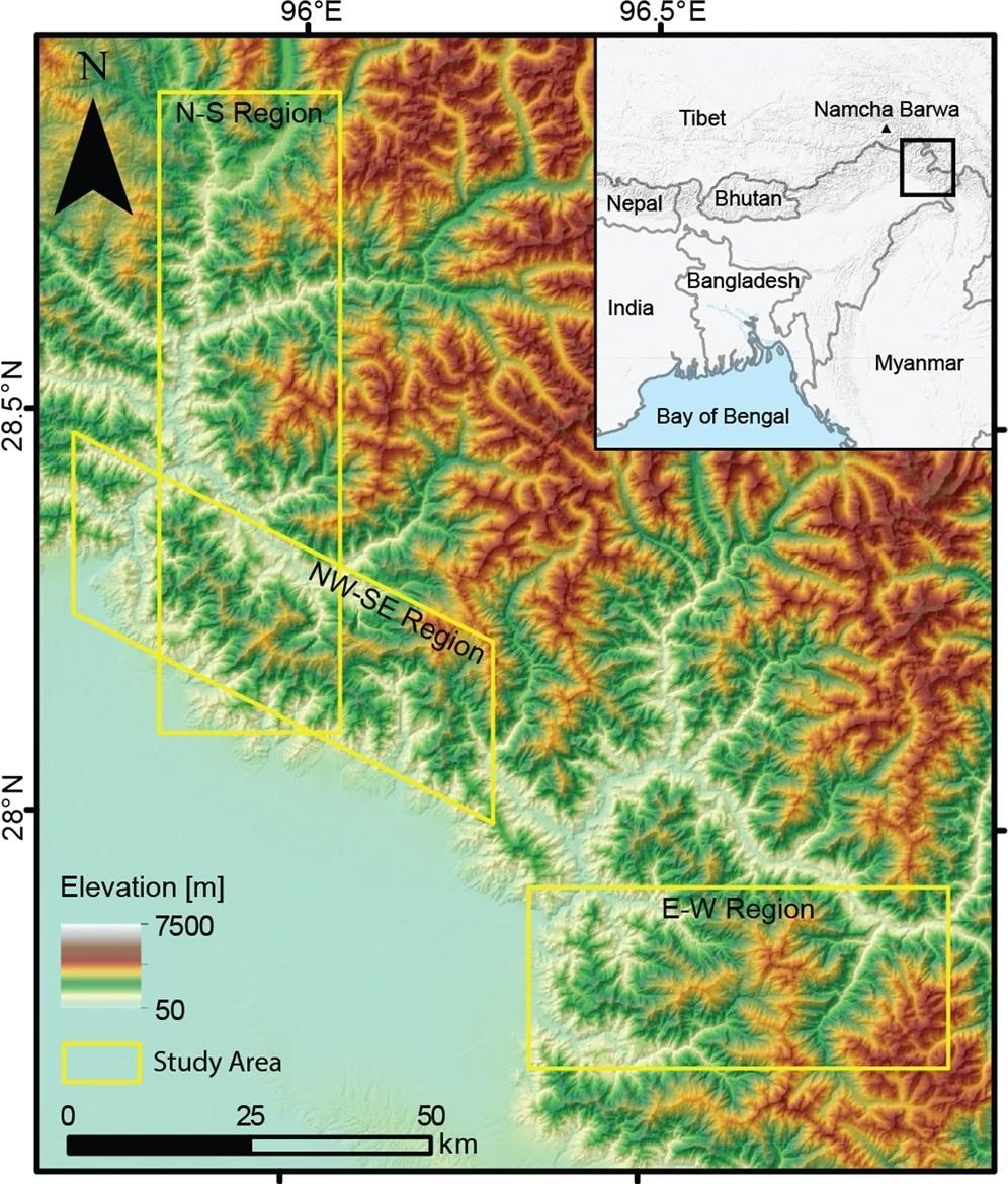
Data pertaining to 15 geospatial and climatic variables relevant to the eastern Himalayan mountains was input into the SNN. This region was chosen given that a significant portion of human losses due to landslides occurs in Asia, with a substantial share in the Himalayas. The SNN model could predict landslide susceptibility for Himalayan areas with an accuracy equating to that of DNNs. Crucially, the researchers could dissect the variables to understand which ones had a greater influence on the results.

Colors represents the elevation, and yellow boxes indicate our N-S (Dibang), NW-SE (range front), and E-W (Lohit) oriented study regions. The inset map shows the eastern Himalayan region with our study area shown in a black box and national borders shown in dark gray lines.
"Like autopsies are needed to ascertain the cause of death, determining the precise trigger for a landslide always necessitates field measurements and historical records of soil, hydrological and climatic conditions, such as rainfall volume and intensity, which are challenging to acquire in remote locations like the Himalayas," Moon observed. "However, our new AI prediction model can identify key variables and quantify their contributions to landslide susceptibility."
The new AI system developed by the researchers also necessitates far fewer computing resources compared to DNNs and can operate effectively with relatively minimal computational power.
"The SNN is so compact it can operate on an Apple Watch, unlike DNNs, which demand powerful computer servers for training," stated Bouchard.
The team intends to expand their work to other landslide-vulnerable regions globally. In places like California, where frequent wildfires and earthquakes exacerbate landslide risk, and in similar regions, the new system may aid in developing early warning systems that consider a multitude of signals and forecast a variety of other surface hazards, including floods.
Source:
Journal reference: